
Blog
AutoCAD for Civil Engineering: When to Upgrade to Civil 3D

AutoCAD for Civil Engineering: When to Upgrade to Civil 3D
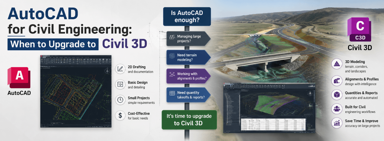
AutoCAD for civil engineering is where most of us start — drafting site plans, marking out setting-out points, and producing construction sheets. But plain AutoCAD has a ceiling, and if you’re spending half your day manually updating contour labels or renumbering cross-sections every time an alignment shifts, you’ve already hit it.
Who this guide is actually for
This isn’t a feature list. It’s for three specific people:
- The site engineer who spends hours manually drafting setting-out points and coordinating between survey data and construction drawings, wondering if there’s a faster way.
- The land-development designer producing grading plans, calculating cut-and-fill volumes, and redoing contour labels every time the surface changes — usually late on a Thursday.
- The CAD manager or small-firm owner trying to work out whether the Civil 3D subscription cost is justified, or whether plain AutoCAD is enough for the work the team actually does.
If you’re a civil engineering student learning the tools, this guide will also help you understand which one to invest your time in — because learning the wrong platform sets you back later.
When plain AutoCAD for civil engineering still works
Let’s be fair. Plain AutoCAD isn’t obsolete for civil work — it’s just limited to specific tasks. Plenty of civil engineering firms still run projects entirely in vanilla AutoCAD without a problem, because the scope never crosses the line into dynamic civil design.
Tasks where plain AutoCAD is perfectly adequate
| Task | Why plain AutoCAD handles it |
|---|---|
| 2D site plans and layout sheets | Lines, polylines, blocks, and annotative text cover this fully — no dynamic objects needed. |
| Construction detailing and section drawings | Manual drafting with Xrefs gives precise control; no corridor model required for isolated details. |
| Markups, RFIs, and as-built redlines | Speed matters more than intelligence — AutoCAD LT or plain AutoCAD opens fast and marks up faster. |
| Setting-out point schedules (static) | If your survey data arrives as a fixed CSV and you’re just drafting coordinates, blocks with attributes do the job. |
| Small-site drainage sketches | For a single lot with a handful of inlets, manual pipe drafting is faster than building a pipe network from scratch. |
If every task in your current workflow sits in the table above, you don’t need Civil 3D today. But keep reading — the trigger point is rarely about the tasks you do daily. It’s about the one project that arrives and changes everything.
Where AutoCAD hits its ceiling in civil work
Plain AutoCAD is a generalist drafting tool. It treats everything as lines, arcs, and text. Civil engineering, by contrast, deals with dynamic relationships: a road alignment shifts, and suddenly the profiles, cross-sections, drainage outfalls, and earthwork quantities all need to update. In plain AutoCAD, every one of those changes is manual. That’s not inefficiency — it’s risk.
AutoCAD for civil engineering works until the first alignment revision. After that, it’s a liability.
The five trigger moments that mean you’ve outgrown plain AutoCAD
- You’re editing contour lines by hand. A surface changes — maybe the geotech report comes back with revised levels — and you’re manually redrawing polylines across 200 hectares. In Civil 3D, you update the surface data and the contours regenerate. In AutoCAD, you clear your weekend.
- Cross-sections break when the alignment moves. You shift a road centreline by two metres. In plain AutoCAD, every section line, every offset, and every annotation label is now wrong. Civil 3D rebuilds the corridor and all sample lines dynamically.
- Pipe inverts and slopes need manual recalculation. A pipe network in plain AutoCAD is just lines and text. Change an upstream invert, and you manually recalculate every downstream invert, slope, and cover depth. One arithmetic slip and the contractor hits a clash in the trench.
- Earthwork quantities come from spreadsheets, not the model. You export areas, paste them into Excel, apply formulas, and hope the numbers match the drawing. Civil 3D calculates cut-and-fill volumes directly from the surface comparison — live, auditable, and tied to the model.
- Multiple disciplines are working off inconsistent base data. The architect’s site plan shows one set of finished floor levels, your grading plan shows another, and the drainage engineer has a third. Civil 3D surfaces, alignments, and pipe networks can be data-shortcut across files so everyone works off a single source.
If you’ve hit two or more of these triggers on a recent project, staying on plain AutoCAD isn’t saving money — it’s costing you unbillable hours and exposing you to coordination errors that show up during construction.
What Civil 3D changes the first week you use it
Civil 3D isn’t a separate application — it’s AutoCAD with a civil engineering brain built in. The interface is the same ribbon-and-command-line environment you already know. What changes is that lines become intelligent objects that carry properties and relationships.
The core civil objects that replace manual drafting
| Civil 3D object | What it replaces in plain AutoCAD | Why it matters for civil engineering |
|---|---|---|
| Surface (TIN) | Manual contour polylines | One surface rebuilds all contours, spot levels, and slope analysis dynamically. Import survey points, LiDAR, or DEM files and the surface updates across every sheet. |
| Alignment | Polyline centreline with manual stationing | Stations, chainage labels, and geometry points are live. Edit the alignment once and profiles, sections, and corridors follow. |
| Profile & Profile View | Manually drafted long-sections | Existing ground and design grades are dynamically linked to the alignment and surface. Vertical curve calculations are built in. |
| Corridor | Hundreds of individually drafted cross-sections | One corridor model generates plans, profiles, sections, and earthwork volumes simultaneously. Lane widths, slopes, and daylighting update when the alignment or assembly changes. |
| Pipe Network | Lines with manually typed invert labels | Pipes and structures carry inverts, slopes, and cover depth. Edit one structure and the connected pipes recalculate hydraulically. Clash detection against surfaces is automatic. |
| Grading | Manual slope projection with offset lines | Grade-to-surface, grade-to-elevation, and grade-to-distance tools project slopes that update when the target changes. Volume calculations between grading and existing ground are instant. |
| Survey Database | Imported points as static blocks | Raw survey data (points, traverses, figure lines) lives in a database. Adjust a traverse and all connected linework updates. Field-book imports preserve survey integrity. |
Quantity takeoff that stays live
In plain AutoCAD, quantity takeoff is an extractive process — you measure areas, count blocks, and export to a spreadsheet. The moment the design changes, the spreadsheet is stale. Civil 3D’s QTO tools tie material volumes to corridor models and surfaces, so when a grading plan adjusts, your cut-and-fill quantities recalculate. For land development projects where earthwork swings can make or break a budget, this alone often justifies the upgrade.
AutoCAD for civil engineering workflows that involve any kind of volume reporting or cost estimation benefit enormously from this live link between the model and the numbers. It turns earthwork from a guess into a defensible calculation.
Role-by-role: who upgrades now, who waits
Not every civil engineer needs Civil 3D. The decision depends on the deliverables you’re responsible for. Here’s how it breaks down by what you actually produce.
| Role | Typical deliverables | Plain AutoCAD sufficient? | Upgrade trigger |
|---|---|---|---|
| Site / setting-out engineer | Setting-out point schedules, coordinate tables, construction markups, as-built redlines | Yes — blocks with attributes and data extraction cover point schedules; Xrefs handle markups | When you start managing survey data directly or need live surface comparisons for earthwork verification |
| Land development designer | Grading plans, earthwork volume reports, lot layouts, drainage area plans | No — manual grading and volume calcs are too slow and too error-prone for multi-lot sites | Immediately — Civil 3D’s grading tools and surface-comparison volumes pay back on the first subdivision |
| Road / highway designer | Alignments, profiles, cross-sections, corridor models, signage and marking plans | No — corridor modelling alone justifies Civil 3D; manual sections are untenable on any road over 500 metres | Immediately — the alignment-profile-corridor chain is the core reason Civil 3D exists |
| Drainage engineer | Pipe networks, inlet and manhole schedules, catchment plans, hydraulic grade line analysis | No — pipe networks with live inverts, slopes, and cover-depth checking are Civil 3D territory | When pipe runs exceed a handful of structures; SSA integration requires Civil 3D pipe data |
| CAD / BIM manager | Template management, standards enforcement, multi-discipline coordination | Depends on team composition | When the team includes civil designers; you’ll manage Civil 3D templates, styles, and data shortcuts centrally |
| Structural engineer (bridges/retaining walls) | Structural detailing sheets, reinforcement schedules, connection details | Yes — structural detailing is 2D-heavy and often better served by plain AutoCAD or Revit, not Civil 3D | Only if you’re also responsible for bridge alignment and grading; otherwise stay on AutoCAD |
If you’re in a multi-role firm, you don’t need a Civil 3D seat for every user. The survey and land-development team need it. The structural detailer and the site engineer can often stay on plain AutoCAD and reference the Civil 3D outputs via Xrefs. Mixing licence types is a standard cost-control strategy.
The honest cost conversation
Let’s talk numbers — real ones, without the vagueness that makes most software comparisons useless.
What Autodesk charges direct vs. what you can actually pay
| Product | Autodesk direct (annual) | Zoftis (annual) |
|---|---|---|
| AutoCAD (plain, Windows) | ~$1,975 | $59 |
| AutoCAD LT | ~$550 | $399 |
| Civil 3D (includes full AutoCAD) | ~$2,635 | $99 |
Two things to notice. First, Civil 3D includes the full version of AutoCAD — you’re not buying two licences. The Civil 3D subscription gives you every AutoCAD command plus the civil toolset. Second, the gap between direct Autodesk pricing and what a genuine reseller can offer is significant, and it changes the upgrade maths entirely.
All licences are genuine Autodesk subscriptions redeemed to your own Autodesk account. You get full access to the Autodesk Account portal, updates, and support — same as buying direct, just at a lower price point. Delivery is by email, typically within 1–12 hours, with a 30-day money-back guarantee.
The break-even calculation that matters
One unbilled weekend of manual contour editing or cross-section renumbering costs a civil engineer more in lost time than the annual Civil 3D subscription. At a modest billing rate, eight hours of rework pays for the licence. If you’re doing that rework more than once a year — and most civil teams are — the software has already paid for itself before the first project closes out.
The question isn’t whether you can afford Civil 3D. It’s whether you can afford the rework that happens without it.
What the switch actually looks like
If you’re already using AutoCAD for civil engineering, moving to Civil 3D is not a rip-and-replace. It’s the same DWG format, the same interface shell, the same command line, the same Xref system, and the same plotting workflow. What changes is that you now have an additional set of tools, objects, and palettes that sit alongside the AutoCAD features you already use.
Things that stay exactly the same
- DWG file format. Civil 3D DWGs open in plain AutoCAD (civil objects appear as proxy graphics or can be exported as standard AutoCAD entities). Your existing drawing library is fully usable.
- All standard AutoCAD commands. LINE, PLINE, TRIM, EXTEND, LAYER, XREF — everything you use daily is still there. Civil 3D adds tools; it doesn’t remove any.
- Plotting and sheet-set management. Your CTB files, page setups, and sheet-set files work unchanged. Civil 3D’s plan-production tools are additive, not replacements.
- Custom LISP routines and add-ons. Most AutoCAD customisation runs in Civil 3D without modification. If you’ve built a library of LISP routines over years, they typically port directly.
What actually requires learning
- Styles. This is the biggest mindset shift. In plain AutoCAD, you control appearance with layers, linetypes, and blocks. In Civil 3D, object appearance is controlled by styles — label styles, surface styles, profile-view styles. It’s more powerful but takes deliberate setup.
- Data shortcuts and references. Civil 3D’s equivalent of Xrefs for civil objects. Once your template has data-shortcut folders configured, sharing surfaces, alignments, and pipe networks across multiple drawings becomes second nature.
- Toolspace. A dockable palette that lists every civil object in the drawing. It replaces the hunt-and-peck of finding objects in model space. Most Civil 3D users keep it open permanently.
Start with one project type, not everything at once. Most civil firms begin with surfaces and grading, then add alignments and corridors on the next project, and tackle pipe networks after that. Trying to learn every Civil 3D object simultaneously is the fastest route to frustration.
For site-plan and land-development work specifically, the migration from plain AutoCAD to Civil 3D typically takes a competent AutoCAD user two to four weeks of project work to reach productive speed on surfaces and grading. Corridors add another two weeks. Pipe networks add a week. By the second project, most users report they would not go back to manual civil drafting, even for small jobs.
Frequently asked questions
Do I lose my existing AutoCAD DWG files if I switch to Civil 3D?
No. Civil 3D uses the same DWG format and opens every AutoCAD file you already have. Your existing blocks, layers, Xrefs, and sheet setups all work. You can continue working on legacy projects in Civil 3D without converting anything — or you can start adding civil intelligence (turning polylines into alignments, point groups into surfaces) as needed.
Can a plain AutoCAD user open and work with Civil 3D drawings?
Yes, with caveats. Civil 3D objects (surfaces, alignments, corridors) appear as proxy graphics in plain AutoCAD. The user can see, plot, and snap to them, but cannot edit the civil intelligence. Civil 3D also includes an “Export Civil 3D Drawing” command that flattens civil objects to standard AutoCAD entities when you need to share with a consultant who only has plain AutoCAD.
Is Civil 3D overkill for small residential subdivision work?
Surprisingly, no. A small subdivision with six lots still needs a grading plan, a drainage area map, earthwork volumes, and a utility plan. In plain AutoCAD, those four sheets might take a week of drafting and calculation. In Civil 3D, a single surface model and one grading object produce all of them simultaneously — and when the client asks for a lot-line adjustment, the update is measured in minutes. Small projects benefit as much as large ones; the proportional time saving is often higher on small jobs where the fee is tighter.
What’s the difference between AutoCAD LT and Civil 3D for civil drafting?
AutoCAD LT is a 2D-only drafting tool with no 3D modelling, no LISP support, and no civil-intelligent objects. It’s suitable for markups, as-built redlines, and simple detail sheets but cannot run any civil-specific workflows — no surfaces, no alignments, no corridors, no pipe networks. Civil 3D includes the full AutoCAD engine plus the entire civil toolset. If your work stops at 2D drafting of civil sheets someone else designed, LT might be enough. If you create the civil design, LT won’t get you there.
How long does it realistically take to learn Civil 3D if I already know AutoCAD well?
A competent AutoCAD user typically reaches productive speed on surfaces and grading within two to three weeks of project-based learning. Corridor modelling adds another one to two weeks. Full proficiency — where you’re building templates, managing data shortcuts, and troubleshooting styles — takes three to six months of regular use. The key is learning on a live project, not a tutorial dataset. Real deadlines force real understanding.
Does Civil 3D handle topographic survey data import automatically?
Yes. Civil 3D imports survey data from raw field-book files, CSV point files, and LandXML. It can build a survey database that preserves traverse adjustments, figure lines, and point groups. The surface-creation tools generate a TIN surface directly from imported points and breaklines. If your surveyor delivers a point file, you can go from raw data to contoured surface in under 30 minutes.
Ready to move from plain AutoCAD to Civil 3D?
Genuine Autodesk Civil 3D for Windows — includes full AutoCAD — from $99/year (regularly $199). Delivered by email within 1–12 hours, redeemed to your own Autodesk account, backed by a 30-day money-back guarantee.
Get Civil 3D for $99/year →Still on the fence? See our AutoCAD pricing if plain AutoCAD is the better fit for your current workload.